The plot as an atom of space
Written by Ericka Renckens. Published on 31-10-2022."Geographical information is a fundamental part of humanities data. All information consists, in the abstract, of 'someone doing something at a certain place'. You can hang anything on that peg. The integration of those types of information and their mutual relationships is becoming increasingly important." Speaking is Thomas Vermaut, developer and team leader of the geographical analysis expertise group which works on processing spatial data with digital infrastructure.
Don't just think about maps, cautions Vermaut. "Geographical information is too complex for just a flat visualisation, because you have a lot of logical relationships between different kinds of geo-data. Think, for example, of the villages in Zeeland that disappeared in 1953, or all kinds of complex shifts of administrative areas such as parishes or marken (in the eastern, dune areas of the Netherlands), and their relationship to the original municipalities from the nineteenth century, and how these subsequently evolved into modern municipalities. These are important relationships to establish in order to move one's analysis and applications to a higher level. This kind of computer-assisted semantic interpretation is getting better and better thanks to new techniques and standards such as Web Annotations. This is a modern way of adding annotations to every possible digital source. Text, images and geographical data thus speak the same language, as it were, and can be linked together.
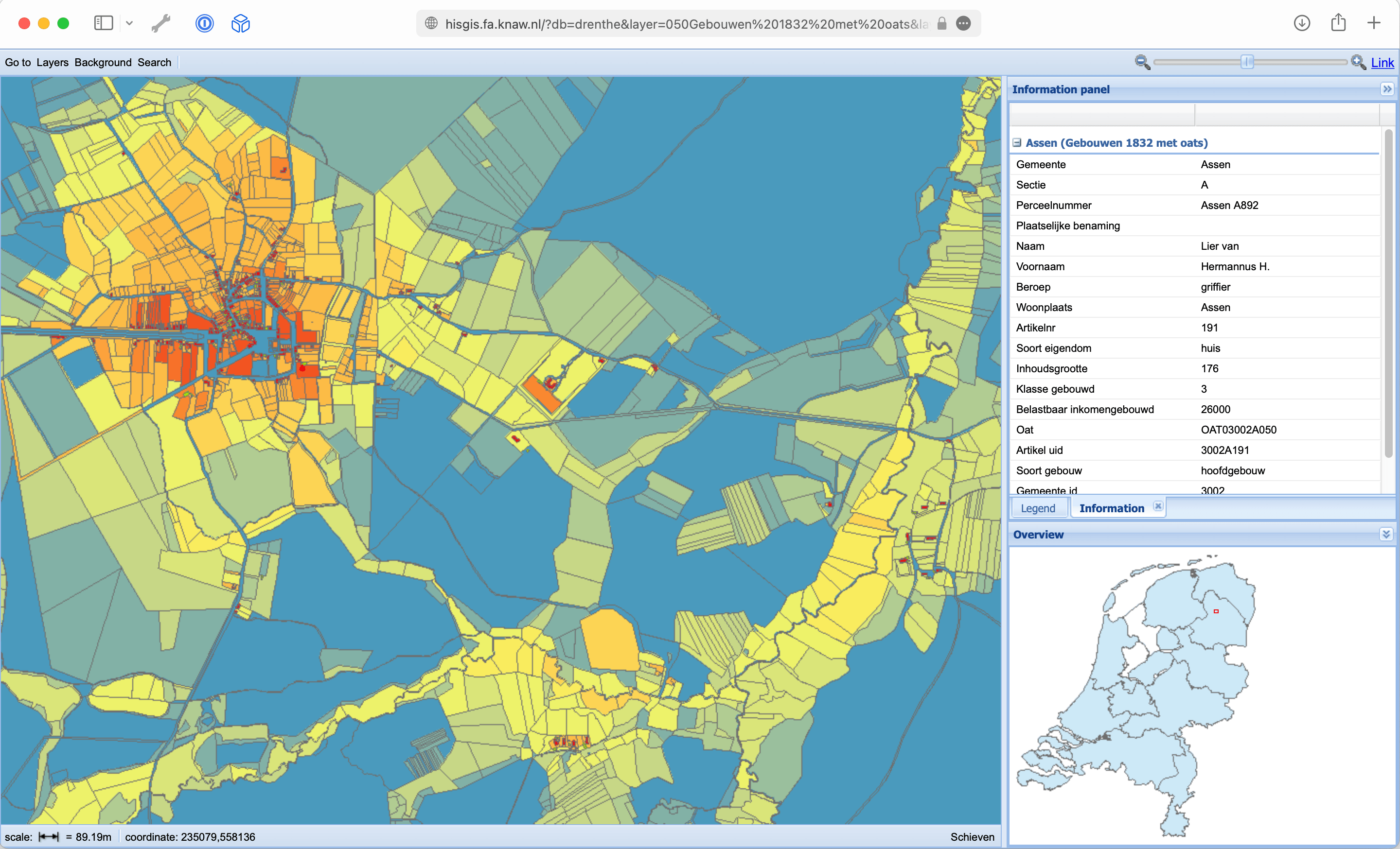
One of the infrastructure platforms managed by the Geo team is HisGIS, which places geographical data in a historical context. "HisGIS was originally started in the 1980s as a project by Hans Mol at the Fryske Akademy. He is still in charge of the project, but since 2019 the technical infrastructure has been coordinated by the HuC," Vermaut says. The basis of HisGIS is the complete 1832 cadastre of the Netherlands, as set up by Napoleon based on the French model.

"The unit we work with in HisGIS is the plot, as an atom of space. With that, you can reconstruct the entire historical context from which things arose." Various other information layers can be connected to this HisGIS base layer, such as elevation files, aerial photos or old topographic maps. This provides valuable information for historians, ecologists, site managers and landscape specialists, but also for governmental bodies such as provinces and municipalities. In the various Time Machine projects, for example, the HisGIS data are supplemented with local historical population data, providing insight into the historical development of cities such as Amsterdam and Leiden.
"We are currently using citizen science to deploy many volunteers to open up sources," Vermaut says. "For this we use OpenStreetMap technology, which allows people to contribute from home. For example, they draw old maps in the browser or transcribe tables belonging to the plots. This data is then linked live."
Another project that the team Geo is involved in is the World Historical Gazetteer. "This project aims to form a historical reference for all possible mentions of a 'place' around the world," Vermaut explains. "Different datasets are brought together into one list, to which users can also add data themselves. Our team helped make version 2.0 of this software possible, which was launched in the summer of 2021. In addition, we also contributed to the Dutch Global History collection for Dutch historical place names and other place names related to Dutch history."


